Nepal is a beautiful country with numerous popular hiking trails. Each of these trails has its own geographical features, including sub-alpine forests and mountain ranges. Hiking in Nepal is one of the best ways to explore the unique landscapes and hidden treasures of the tranquil countryside, making it suitable for both couples and families.
Kathmandu Valley, located in the central part of Nepal, is surrounded by stunning hills, diverse ecosystems, and religious sites, making it a paradise for hiking. Exploring the valley offers a welcome break from the hustle and bustle of city life.
If you’re in the valley and craving fresh air and beautiful views with your family within a short time, you’ll find hundreds of popular one-day and two-day hiking destinations. Here, we’ve compiled a list of the top 10 hiking destinations around Kathmandu Valley.
1. Phulchowki Hike
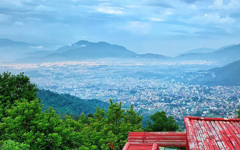
Phulchowki, also known as the Hill of Flowers, is a popular short hiking destination for couples, located southeast of Kathmandu. It is one of the highest hills in the Kathmandu Valley, offering a variety of vegetation and different species of birds. The magnificent views of the snow-capped peaks will relieve the fatigue of your hike and rejuvenate your soul.
Your hike to Phulchowki begins at Godavari, where you will walk uphill through a dense sub-tropical forest for about 4 hours. Upon reaching the top, you will enjoy breathtaking views and have lunch. From there, you will hike downhill for about 2 hours back to Godavari, following the same route, and then drive back to Kathmandu.
The hiking trail is remote and does not have any human settlements, so be sure to bring food and water with you before starting the hike.
Getting There
You can reach Godavari through the local bus or private vehicles. You can get access to the local bus from Ratnapark to Lalitpur. And you can head towards Godavari from Lalitpur. You will drive towards 14 km south of Kathmandu and reach Godavari in around 30 minutes.
Bike ride to Phulchowki is difficult as it has unpaved and bumpy narrow trail but is driveable.
Phulchowki Hiking Facts
| Starting Point: | Kathmandu |
| Ending Point: | Kathmandu |
| Driving: | Kathmandu to Godavari, 30 minutes (14km) |
| Hiking Duration: | Godavari to Phulchowki, 2.5 hours (13km) |
| Max. Altitude: | 2,782 meters (9,127 feet) |
| Best Season: | Throughout the year (Jan to Dec) |
Phulchowki Hike Highlights
- Godavari Botanical Garden
- Birdwatching
- Wonderful views of Kathmandu valley
- Slight glimpse of peaks like Annapurna, Dhaulagiri etc.
- Different species of birds like Flycatcher, Rufous-bellied Niltava, Yellow-browed Tit, Grey-headed Woodpecker etc.
- Exploration of sub-tropical forests filled with Rhododendron.
2. Sundarijal Hike
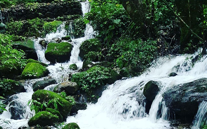
Sundarijal is a popular hiking destination which is 15km north-east from Kathmandu and is popular among couples. It is the gateway for Chisapani hiking. Numerous waterfalls, water reservoir sites, green lush forests, hilly ridges etc. are the attractions of this hiking trail. Since, we need to pass through Shivapuri National Park to reach Sundarijal, we can also explore the Conservation Area and enjoy the birds chirping.
You can only get access to small shops where dry food can be bought, so we suggest you pack the lunch from home.
Getting There
Drive to Budhanilkantha via Maharajgunj either in private or public vehicles. You can get access to numbers of local buses departing to Budhanilkantha from Thamel, Ratnapark. From Budhanilkantha, you will hike to Shivapuri’s Conservation Area and from there to Tare Bhir (Famous for rock climbing) and will reach Sundarijal.
The Sundarijal hiking trail is very suitable for cycling rather than biking as it has a narrow route.
Sundarijal Hike Facts
| Starting Point: | Kathmandu |
| Ending Point: | Kathmandu |
| Driving: | Kathmandu to Budhanilkantha |
| Hiking Duration: | Budhanilkantha to Sundarijal, 5 hours (18km) |
| Max. Altitude: | 2,340 meters (7,677 feet) |
| Best Season: | Throughout the year (Jan to Dec) |
Sundarijal Hike Highlights
- Budhanilkantha Temple
- Passing through the Shivapuri National Park
- Exploring dense forests covered with Rhododendron, Pine, waterfalls, flora and fauna.
- Nagi Gompa (Monastery)
3. Champadevi Hike
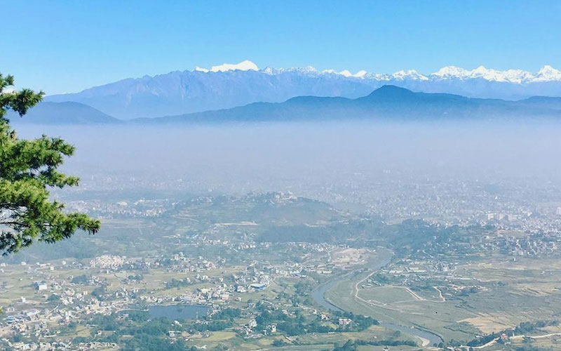
Champadevi hill is one of the best 1-day hikes with family members and also a popular hiking destination around the Kathmandu valley. It is the third highest hill surrounding the Kathmandu valley. This hiking trail gives you an opportunity to visualize the whole Kathmandu valley from the top of the hill. Similarly, you get to learn about the culture and traditions of locals.
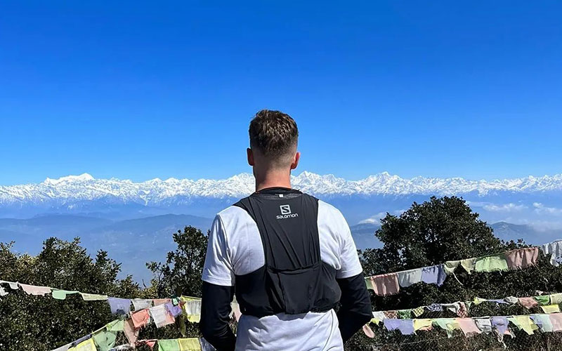
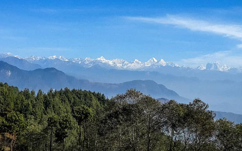
Champadevi hiking is also popular among the pilgrims as it has many Hindu and Buddhist sacred places. Ranging from old monasteries to Dakshinkali temple, it has great historical importance. Moreover, this hillside provides a clear panorama of peaks such as Mt. Ganesh, Mt. Langtang Lirung, Mt. Annapurna, Mt. Gaurishankar etc.
Both private and public vehicles are available for this hike. From Ratnapark you can get on a local bus departing to Dhaksinkali. You will drive about 17km south of Kathmandu to reach Dhaksinkali from where your hiking starts. From Dhaksinkali you will hike across the small trails in the dense forest to reach Hattiban resort. From the resort, your trail gets wider, and you will start to see stunning views. After 3 hours of hiking, you will reach Champa Devi Temple.
Getting There
Hiking to Champadevi through bike ride is possible from Chobhar, Kritipur route where you will be leading on a dirt road to Bansbari.
Champadevi Hike Facts
| Starting Point: | Kathmandu |
| Ending Point: | Kathmandu |
| Driving: | Kathmandu to Dhaksinkali, 40 minutes (17km) |
| Hiking Duration: | Dakshinkali to Champadevi, 3 hours OR Kritipur to Chamadevi, 2.5 hours (4.8km) |
| Max. Altitude: | 2,278 meters (7,470 feet) |
| Best Season: | Throughout the year (Jan to Dec) |
Champadevi Hike Highlights
- Slight glimpse of Ganesh and Langtang range
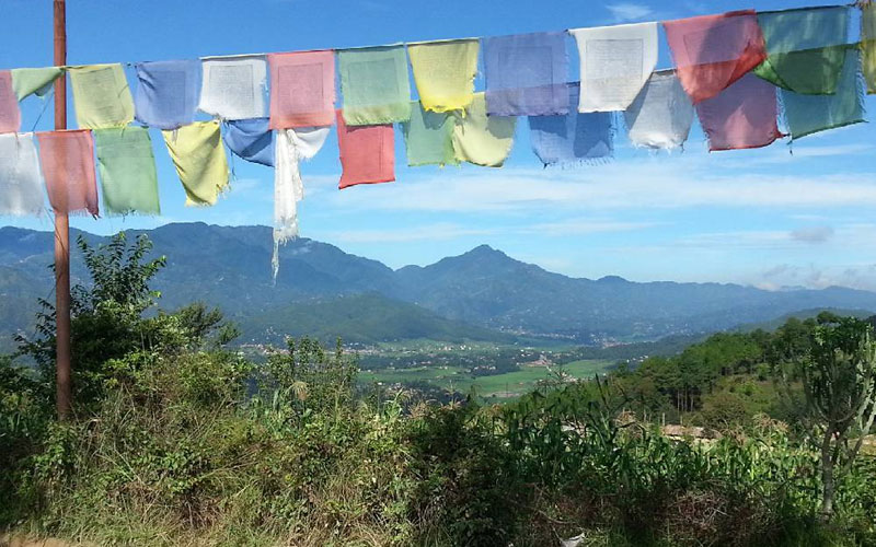
- Passing through the traditional villages of Tamang people filled with prayer flags and Mani walls.
- Beautiful view of Kathmandu valley, Kirtipur, Pharping, Bungmati and Khokana villages
- Observing the Bagmati river, Pharping and Dakshinkali temple
- Visiting the sacred Buddhist shrines and monasteries
4. Chisapani Hike
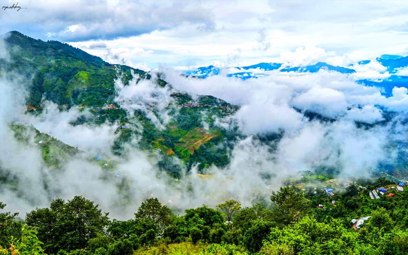
Located in the northern outskirts of Kathmandu, Chisapani hiking takes you to the small hill station. This hiking trail takes you to the deep valleys from where views of lush green hills and snow-capped peaks are clear. It is surrounded by Shivapuri National Park and is the gateway to the Langtang-Gosaikunda trekking region. Hike to Chisapani begins from Sundarijal, a small village in the southeast of Kathmandu, where numerous small rivers and waterfalls can be found.
Hiking to Chisapani is a popular 2-day hiking trail which can be accomplished by family as well as couple. You will be spending overnight in the lodge of Chisapani and do the village excursions, nature and forest walk the next day.
Getting There
Since the entry point of hiking is Sundarijal, you need to drive from Kathmandu to there either on private vehicles or local bus. You can easily find the local bus leaving from Ratna park to Sundarijal on a daily basis. You will hike uphill through the Rhododendron forest of Shivapuri National Park which leads to Chisapani village.
Bike ride to Chisapani is possible, however because of unpaved and bumpy road you need to be the one with high riding skill having bike in good condition.
Chisapani Hike Facts
| Starting Point: | Kathmandu |
| Ending Point: | Kathmandu |
| Driving: | Kathmandu to Sundarijal, 1.5 hours (20km) |
| Hiking Duration: | Sundarijal to Chisapani, 4 hours (7km) |
| Max. Altitude: | 2,140 meters (7,051 feet) |
| Best Season: | Throughout the year (Jan to Dec) |
Chisapani Hike Highlights
- Exploring Shivapuri National Park
- Slight glimpse of white mountains such as Mt. Everest, Mt. Langtang, Mt. Gauri shanker, Mt. Annapurna, Mt. Manaslu, Ganesh Himal etc.
- Walking through the dense lush forest filled with Rhododendrons and Pine trees
- Exploration of local villages inhabited by Buddhist and interaction with the locals.
- Visiting numerous Buddhist and Hindu sacred places being preserved from ancient time.
5. Shivapuri Hike
Shivapuri hiking is the popular hiking trail near Kathmandu to those who love bird watching and are religious. Located in the north of Kathmandu, this hiking trail offers the Himalayan views of Langtang range and Rolwaling range along with the Kathmandu valley view. Similarly, peace and warm walk through green lush forest and terrace while visiting religious sites like Budhanilkantha temple, Nagi Gompa etc. makes this 1-day hike unforgettable experience of your life.
Getting There
First, you will drive from Kathmandu to Budhanilkantha. You can reach Budhanilkantha either on local bus or private vehicles. Local buses are available from Ratna Park bus stop. However, from Budhanilkantha, there will be no availability of local buses for further driving. Your next stop will be Muhanpokhari from where you will obtain the entry permit to Shivapuri National Park.
Riding a bike for Shivapuri hiking is dangerous because of the rugged and steep road. So, try to avoid bike riding and go for a car, taxi, jeep etc.
Entry permit fees for Shivapuri Nagarjuna National park is:
| Nepali citizen: | NRs 100 per person per entry |
| SAARC Nations: | NRs. 600 per person |
| Foreigners: | NRs. 1,000 per person |
| Free for below 10 years children |
Shivapuri Hike Facts
| Starting Point: | Kathmandu |
| Ending Point: | Kathmandu |
| Driving: | Kathmandu to Buddhanilkantha, 45 minutes (10km) |
| Hiking Duration: | Budhanilkantha to Shivapuri, 3.5 hours (14km) |
| Max. Altitude: | 2,732 meters (8,963 feet) |
| Best Season: | Throughout the year (Jan to Dec) |
Shivapuri Hike Highlights
- Hiking through the Rhododendron and Bamboo forest
- Exploring Shivapuri National Park
- Enjoying the beauty of Langtang Lirung, Ganesh Himal, Dorji Lhakpa etc.
- Nangi Gompa (Monastery)
- Budhanilkantha Temple
6. Nagarkot Hike
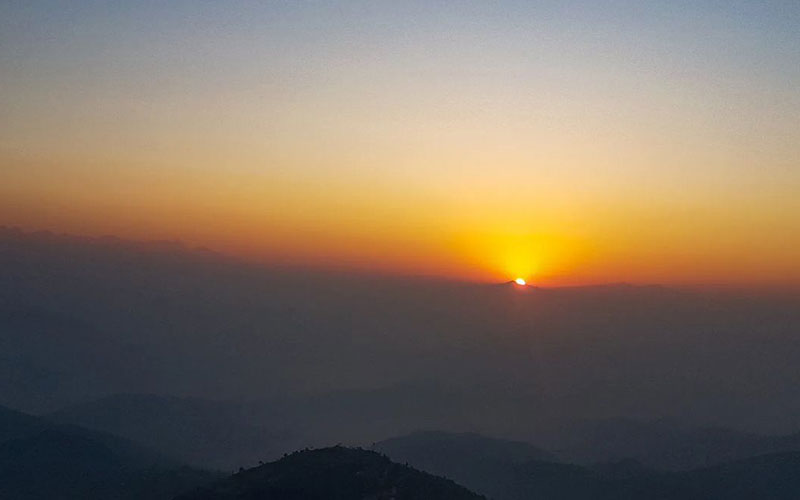
Nagarkot, also known as the International Hill Station, is a popular day hiking trail in Nepal, especially favored by couples. Located in the Bhaktapur district, it is 32 km east of Kathmandu. This hillside is renowned for its stunning sunset and sunrise views, as well as its snow-capped mountains. Nagarkot is a 2-day hiking destination where you will stay at a resort to fully enjoy these spectacular vistas.
The Sankhu route offers insight into the Newari community residing in Sankhu. You can also observe various religious activities performed during festival seasons in this town. From Sankhu, you will cross the Sali River and continue hiking towards the Chisapani and Nagarkot Short Trek Eco-Trail. Enjoy birdwatching and diverse vegetation along this trail. After a period of rest, you will drive back to Kathmandu.
Getting There
Hiking to Nagarkot can be accessed through different routes but we recommend you the Sankhu route. You can drive to Sankhu from Kathmandu either on private vehicles or local buses. Local buses to reach Sankhu are easily available from Ratna park.
If you are riding a bike then you need to know that the road of Sankhu is bumpy and gets slippery in the monsoon Season (June, July, August). So, service your bike before heading towards the destination.
Nagarkot Hike Facts
| Starting Point: | Kathmandu |
| Ending Point: | Kathmandu |
| Driving: | Kathmandu to Sankhu, 1.5 hour (23km) |
| Hiking Duration: | Sankhu to Nagarkot, 3 hours (14km) |
| Max. Altitude: | 2,195 meters (7,201 feet) |
| Best Season: | Throughout the year (Jan to Dec) |
Nagarkot Hike Highlights
- View of sunset and sunrise
- Nagarkot view tower
- Stunning views of Annapurna range, Manaslu range, Ganesh Himal range, Langtang range, Jugal Himal range, Rolwaling range etc.
- Exploring Newari town, Sankhu
- Crossing the Sali river
- Walking through the dense lush forests while observing varied flora and fauna
7. Nagarjuna Hike
Nagarjuna Hiking is one of the best hiking destinations around Kathmandu Valley. It’s ideal for travelers who want to explore nature with their partner but have limited time. This trail leads to the Jamacho Monastery, where you can enjoy stunning views of the Kathmandu Valley and the northern Himalayan range, including Langtang. The route is located in the middle of Shivapuri National Park, which is home to 177 species of birds, 9 endangered species, and 102 species of butterflies.
Getting There
Nagarjuna Hiking route is easy as first you need to drive from Kathmandu to Balaju. You can reach Balaju by jeep, car, bike or local bus. Balaju bus departs from Ratna park on a daily basis. From Balaju water garden, you will take the permit to enter the National park and reach Monastery through a long steep walk.
Nagarjuna Hike Facts
| Starting Point: | Kathmandu |
| Ending Point: | Kathmandu |
| Driving: | Kathmandu to Balaju, 30 minutes (13km) |
| Hiking Duration: | Balaju to Jamacho Monastery, 2.5 hours (6km) |
| Max. Altitude: | 2,150 meters (7,054 feet) |
| Best Season: | Throughout the year (January to December) |
Nagarjuna Hike Highlights
- Walk on the Nagarjuna Shivapuri National Park
- Breathtaking view of the Kathmandu valley and Langtang range
- Jamacho Monastery
- Nature walks through the dense forest full of Oak, Rhododendron, Bamboo, Pine etc.
- Prayer flags waving on the way.
- Balaju water garden
8. Kakani Hike
Kakani is one of the best hiking tours which is in the north-west of Kathmandu, Nepal. You will be walking alongside the green paddy fields by exploring the traditional villages of pristine Nepalese. This place is famous for Himalayan Trout Fish and local homemade Rakshi. You can also see the Seasonal strawberry farming on the way and if lucky you can see villagers making wine from it. Besides these, your hiking trails are covered with Rhododendron and Pine trees.
Visiting national treasures such as Thai Memorial Park which commemorates the untimely demise of 113 people in 1992 on Thai airline crash.
Getting There
Your 1-day hike to Kakani starts with a short drive from Kathmandu to the Kakani bus stop. You can travel by private vehicle or take a local bus from Balaju bus stop.
Kakani is a key gateway for mountain biking routes leading into Shivapuri National Park.
Kakani Hike Facts
| Starting Point: | Kathmandu |
| Ending Point: | Kathmandu |
| Driving: | Kathmandu to Kakani, 1.5 hours (24km) |
| Hiking Duration: | Kakani to Surya Chaur, 3.5 hours (14km) |
| Max. Altitude: | 2,079 meters (6,818 feet) |
| Best Season: | Throughout the year (January to December) |
Kakani Hike Highlights
- Breathtaking view of snow-capped peaks such as Langtang Himal, Ganesh Himal, Manaslu, Annapurna, Fishtail, Dorje Lakpa etc.
- Exploring the Thai Memorial peaceful parks and indulging in meditation
- Station for Armed Police force
- Local Monastery constructed by Korean monks.
- Interacting with the Tamang’s’ community
- Local ethnic food such as homemade Rakshi and Himalayan Trout Fish
- Stunning view from Surya Chaur
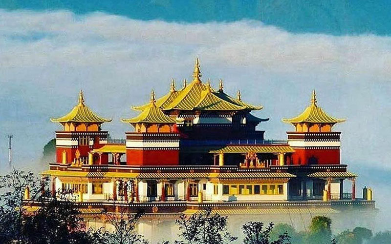
9. Namobuddha Hike
Namobuddha, a popular hiking hilltop, is located southeast of Kathmandu which is the ultimate holiday destination of Buddhist pilgrims as well as Hindu family members. It is believed that King Mahasattva cut his own flesh to feed the tigress in this place. Views of Monasteries, shrines, Stupas and Himalayas from the top of the hill makes this trail worth hiking. You can also see the green cultivable lands capable of growing rice, millet and mustard.
Getting There
You can get to Panauti either on a private vehicle or public bus. You can find a direct Local bus to reach Panauti from Ratnapark. Also, from Panauti you can directly reach Namobuddha within a short period. If you go by car or bike, then you can reach within 30 to 40 minutes but by local bus it will take around 1.5 hours.
Bike riding is also easily accessible as the road from Panauti to Namobuddha has been constructed. Remember to service your bike because you are riding on a high hill.
Namobuddha Hike Facts
| Starting Point: | Kathmandu |
| Ending Point: | Kathmandu |
| Driving: | Kathmandu to Panauti, 1 hour (34km) |
| Hiking Duration: | Panauti to Namobuddha, 3 hours (11km) |
| Max. Altitude: | 1,940 meters (6,365 feet) |
| Best Season: | Throughout the year (January to December) |
Namobuddha Hike Highlights
- Thrangu Tashi Yangtse Monastery
- Beautiful hillside terrace farm
- Tamang settlement and the traditional villages in Panauti
- Plethora of temples, stupas, varied landscaped and harmony among the locals.
- Serene environment suitable for meditation
10. Amitabha Monastery (White Gumba) Hike
Located in the southern part of Kathmandu Valley, Amitabha Monastery, also known as Seto Gumba (White Monastery), is a popular hiking destination for witnessing both sunset and sunrise with family. Its vibrant surroundings and rich culture attract many hikers each year. Hiking this trail offers peace and serenity, enhanced by the waving prayer flags, sounds, and aromas.
Getting There
You can reach Swayabhunath on public bus or private vehicle. Local buses are easily accessible from Ratnapark. If you go through a public bus, then you need to walk from a junction of Ramkot. But, if you take a jeep, car or bike, then you can straight take it to White Gumba. We suggest you take either a car or bike which are in good condition but not scooters, because Gumba is uphill, and the trail is steep.
On bike/car, you can reach the top of Gumba within just 20 to 30 minutes. Road is a little bumpy but is driveable easily.
Amitabha Monastery Hike Facts
| Starting Point: | Kathmandu |
| Ending Point: | Kathmandu |
| Driving: | Kathmandu to Swaymbhunath, 20 minutes (6km) |
| Hiking Duration: | Swaymbhunath to White Gumba, 2 hours (7km) |
| Max. Altitude: | 1,500 meters (4,921 feet) |
| Best Season: | Throughout the year (January to December) |
Amitabha Monastery Hike Highlights
- Beautiful view of sunset and sunrise
- Rich in architecture, statues and Thangka paintings
- Hiking along the way covered with prayer flags, chorten, mani walls etc.
- Peaceful atmosphere
- Stunning view of Kathmandu valley
- Murals and paintings
Things to know while Hiking in Kathmandu.
- Do not throw wastes and garbage on the trail. Dispose them carefully.
- Avoid teasing or feeding animals that you encounter in the routes.
- Remember to carry necessary permits!
- While planning for hiking in Nepal, keep the weather in mind.
- Always go for the local travel agency registered in Nepal and experienced guide.
- Respect the culture of the locals and interact with them friendly.
- If you are hiking in Nepal for the first time, hike in a group rather than independently.
Packing list for Hiking Around Kathmandu Valley
Be it for a 1-day hike or 2 days hike, packing wisely and minimally is always the best decision. Some of the important packing list for short hiking in Nepal are:
- Clothing (Lightweight cotton clothing)
- Flashlight
- Knife and rope
- Toiletries
- Sunglass and sunscreen
- Insect repellent
- Portable charger
- Camera
- Lighter
- Local Map
- Local currency
- Necessary Permits etc.
Nepal is truly a paradise for hiking and trekking, offering not only breathtaking views but also peace of mind and soul. The trails here reward you with stunning mountain vistas, natural beauty, and both physical and mental rejuvenation. Hiking around the Kathmandu Valley is a cost-effective and quick option for those short on time.
For a more adventurous and challenging experience, consider some of Nepal’s best short treks, designed to be completed within a limited timeframe. With Prime Himalayas, you’ll have access to expert guidance and tailored experiences that ensure an unforgettable trek. If you’re unsure about the best short hiking destinations or routes for your journey, we’re here to help. Our experienced guides are ready to lead you through Nepal’s stunning landscapes. To discuss your options or get more details, feel free to reach out to us on WhatsApp +977 9851057582 at your convenience..